REcommunity true false Almo Nature true false
eu-bio-diversity-corridors

EU Biodiversity
Corridors

The project aims to identify and connect European ecological corridors to improve biodiversity conservation.

Project directly conducted

Objective

Protected Areas and the ecological connections between them form the backbone of biodiversity conservation, providing wildlife with suitable spaces to reproduce, rest, and feed, while maintaining natural continuity and thereby supporting the delivery of essential ecosystem services.

Today, the most important areas for ecological connectivity are embedded within a matrix heavily shaped by human activity, which reduces their biological value.

Moreover, EU-funded research projects on ecological connectivity often conclude with maps and recommendations that are rarely implemented on the ground.

The EU Biodiversity Strategy Bringing nature back into our lives, approved by the European Parliament, sets two major targets for 2030: improving the conservation status of species and habitats and protecting 30% of EU territory, of which 10% must be strictly protected.

The EU explicitly highlights the Trans-European Nature Network, which should be strengthened and enhanced. To achieve the improvement target for 30% of species and habitats listed under the Habitats Directive, it is crucial to identify the key nodes of the ecological network and all its connectors, ensuring their effective protection.

The goal of this iniative is to develop a large-scale scientific study capable of defining Europe's most important ecological corridors, thereby enabling the design and implementation of concrete projects to reconnect fragmented habitats. Through this scientific work, it will be possible to mobilise public and private resources to ensure the effective measures needed to restore biodiversity balance.

05_PotentialCorridors_cwd 1
06_Intersection_river_corridors 1

Project

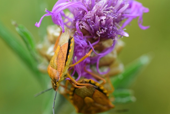
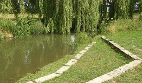
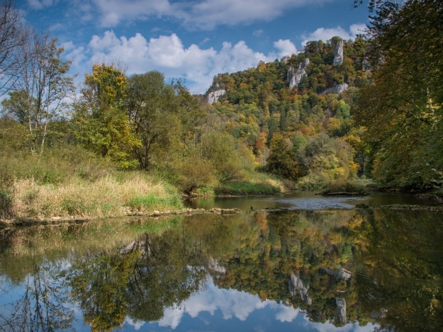
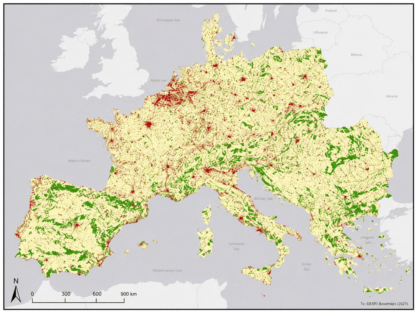
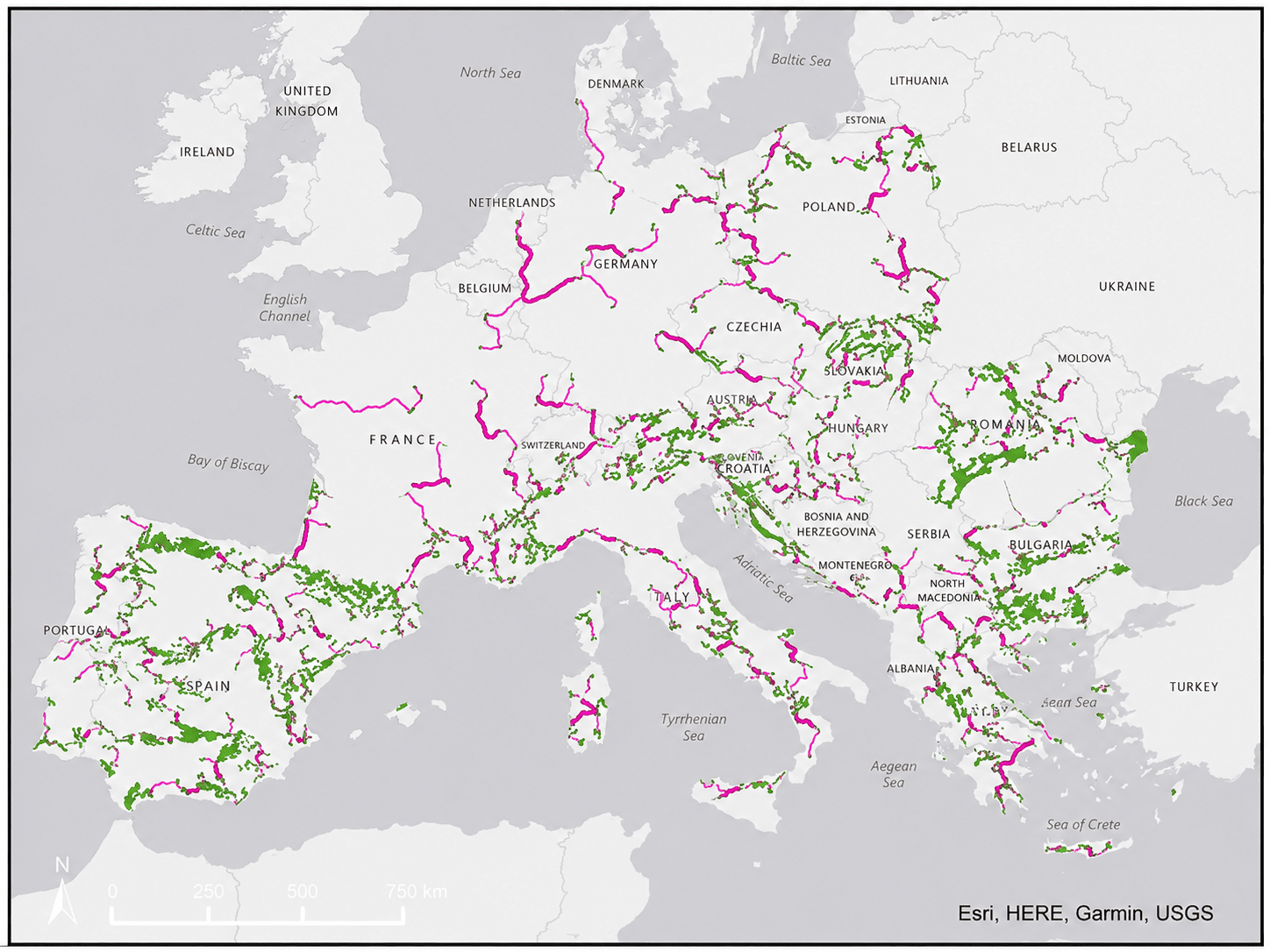
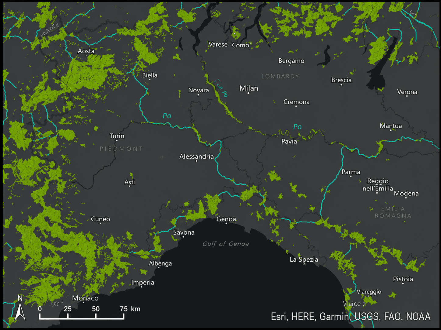
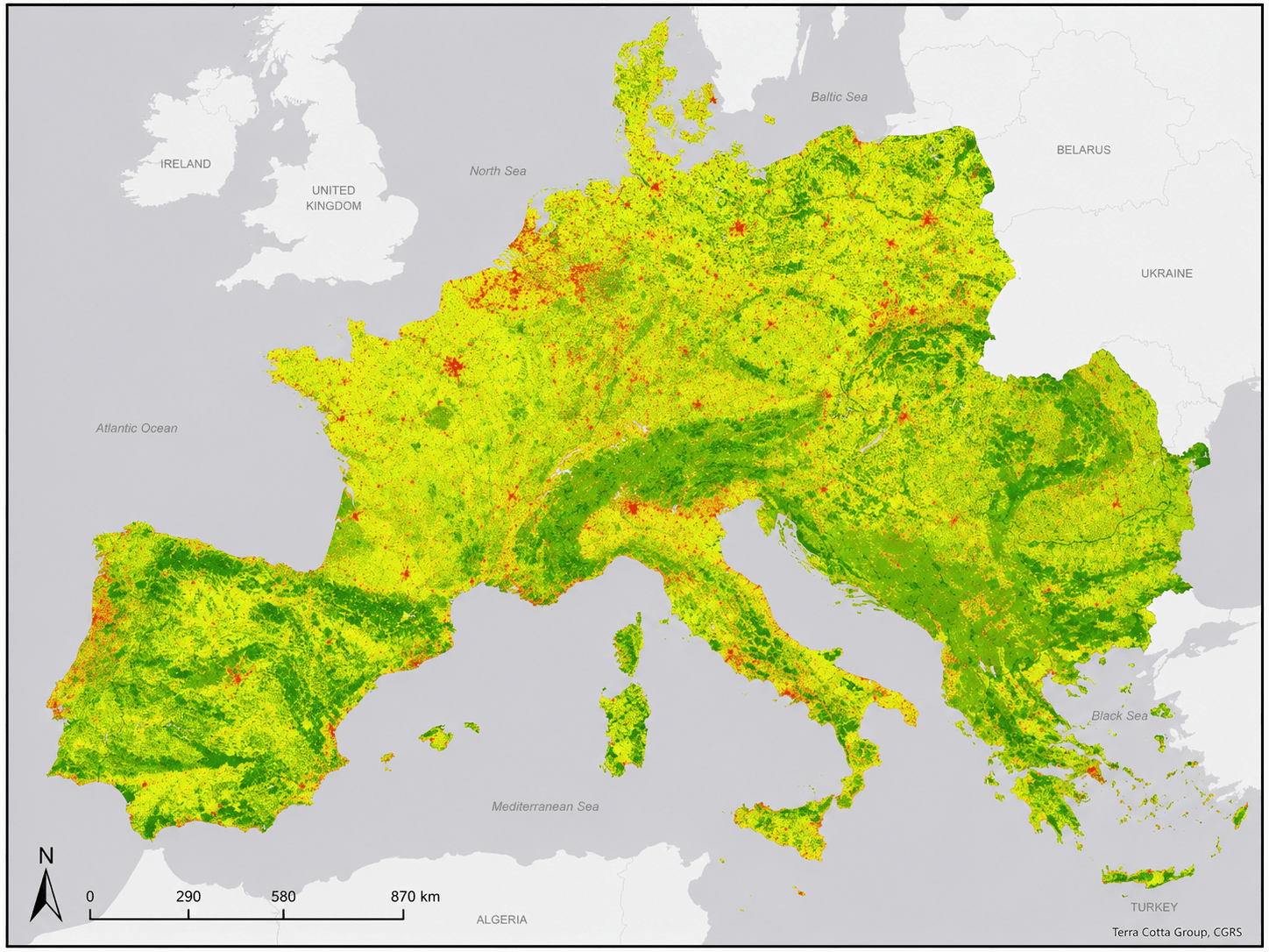
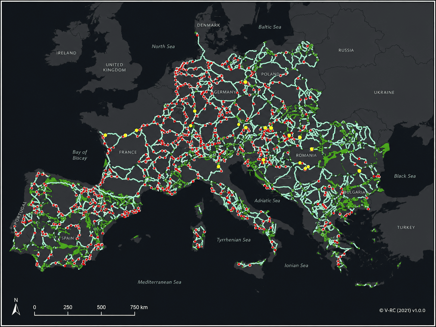
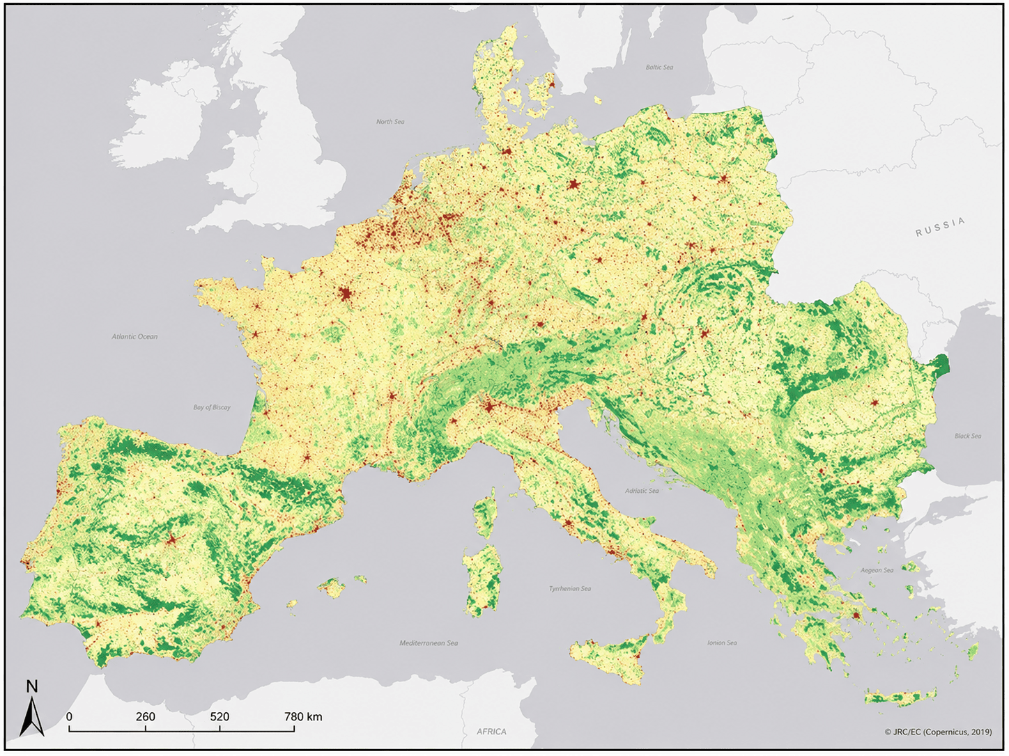
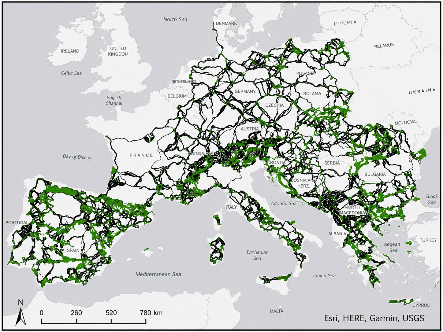
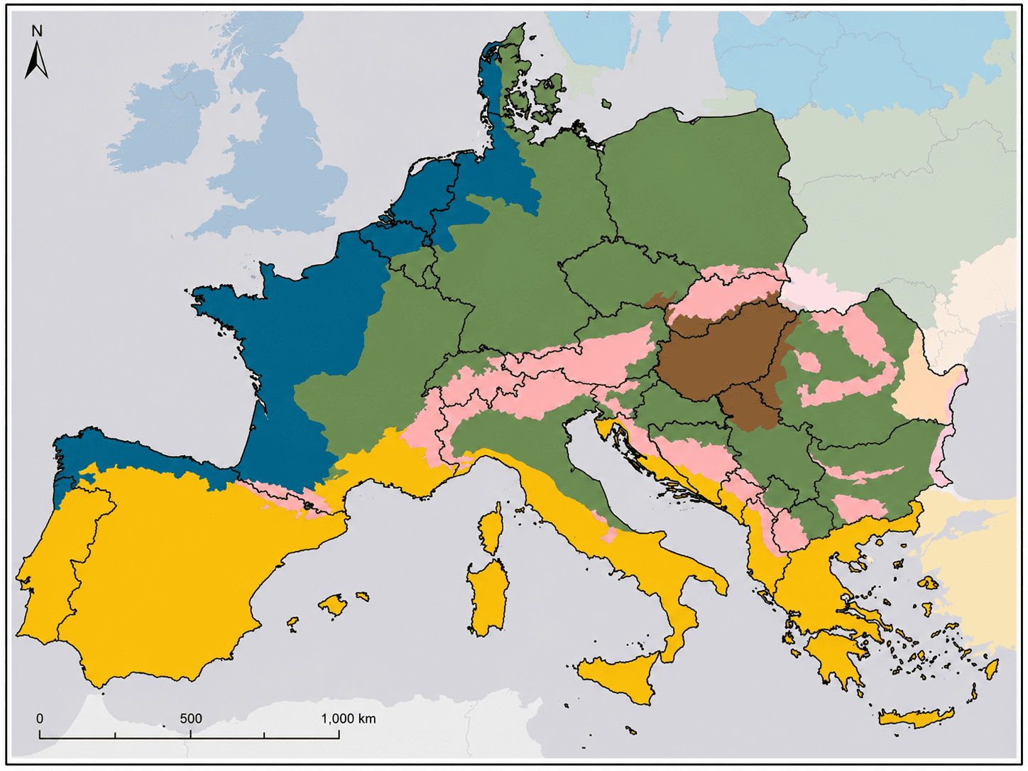
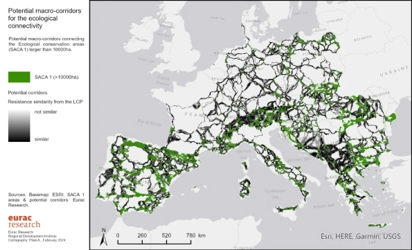
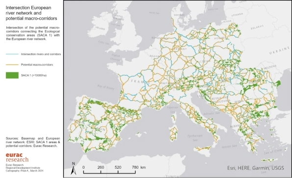
Work has focused on designing a map of priority solutions for connecting existing protected areas in Europe, with the Natura 2000 network serving as the backbone. This is achieved by improving the connectivity of fragmented environments, developing ecological corridors, and considering the broader landscape and the degree of biodiversity degradation. The process is grounded in scientific analysis, identifying the best opportunities to enhance connectivity and strengthen the network. These biodiversity corridors were defined with careful attention to the need to intervene in harmony and balance with the surrounding areas inhabited and used by humans.
eu-bio-diversity-corridor-1
eu-bio-diversity-corridor-2

Starting from the overall vision provided by the detailed maps produced, a European network of major biodiversity corridors was identified. This network can serve as guidance and therefore offer relevant policy value, particularly for the Nature Restoration Law. Specifically, this extraction represents a true connectivity skeleton, capable of ensuring biodiversity resilience even in the face of extreme events, climate disruptions and similar pressures. It is also an actionable framework, not merely a theoretical map impossible to implement, on which priority intervention areas have been identified through a gap analysis.

This project has therefore enabled us, and will continue to enable us, to develop:

  1. A comprehensive analysis of the current Trans-European Nature Network,

    including a state of the art overview and the systematisation of all existing studies.


  2. A new mapping of biodiversity corridors at the European scale,

    identifying of barriers and priority areas for intervention to improve connectivity and conservation, thereby strengthening the resilience of the ecological network.


  3. Contextualisation of the results and concrete proposals for action,

    based on the mapping above; initiation of interventions in selected pilot sites (currently underway in Germany); development of technical guidelines for transferring the activities across the entire Trans-European Ecological Network, accessible to Member States for designing their respective intervention plans to be submitted by 2026 in accordance with the Nature Restoration Law.


  4. Socio-economic analyses

    to assess the costs and benefits of habitat restoration, conservation, and management actions.


  5. An evaluation of financing options

    for interventions in the identified sites, and engagement with national and international institutions as well as partner organisations to identify the most suitable legislative instruments to ensure concrete implementation in each country, in line with the Nature Restoration Law.

eu-bio-diversity-corridor-3

DURATION


1 year (renewable for 5 years) starting from 01.04.2023

OUR INVESTMENT

€ 175.328,00

a29066a1-95c9-43a8-bc8d-9a095b0e7cd7
2023 – 2024

EU Biodiversity Corridor

Project updates

Key developments in the study on potential European ecological macro-corridors, from 2023 to 2024. Use the arrows or the bar below to navigate.

Apr-Jun 2024

Main scientific result

The study produces a theoretical map of potential European macro corridors based on 595 SACA1 areas covering more than 10,000 hectares, connected using a resistance matrix. The model identifies 1,625 possible connections, with a total length of more than 105,000 km, while also highlighting the role of major river systems and infrastructure barriers.

0f4d5602-6bf2-489a-af72-b24804f7f0c3
Apr-Jun 2024

Final report and systematisation of the method

In April, the report ‘Ecological Connectivity in Europe: Structural Analysis at Macro Regional Level - Potential EU Macro Corridors’ was finalised and shared. The work describes the methodology, datasets, the CSI model, SACA classification, the resistance matrix, the analysis of potential ecological connections, barrier analysis and network centrality.

3b7ffb01-f096-441d-8bf3-0c51151d95ec
Jan -Mar 2024

Delivery of the macro corridor analysis

In March, the analysis of potential macro corridors is finalised and submitted. Additional analyses are carried out using the same cartographic base, confirming the transition from an initial modelling phase to a more complete and operational framework for interpreting European ecological connectivity.

f3f1d0e7-d3c3-400c-a98d-f47a13728cff
Jan -Mar 2024

Validation and refinement of the analysis

At the beginning of 2024, the draft map of potential macro corridors was presented and shared with Fondazione Capellino. Refinement continues through barrier analysis calculations and assessments aimed at prioritising the identified corridors. This phase seeks to make the map not only descriptive but also useful for identifying the critical points of the future European ecological network.

c890f2c5-91d7-439a-9586-b4972f179ef0
Oct-Dec 2023

Development of the analysis of potential macro corridors

In the fourth quarter, the analysis of potential macro corridors is carried out. The project moves from mapping ecological permeability to building a theoretical network of links between the main European natural areas, using the resistance matrix and the principle of least cost pathways. In December, the analysis is finalised and delivered.

ce1ced57-6be9-42b8-a075-40da4148fc98
Jul - Sep 2023

Completion of the first European analysis

In September, the CSI ecological barriers analysis was completed at the European level. The work therefore moves beyond landscape permeability assessment towards testing corridor modelling.

0f4d5602-6bf2-489a-af72-b24804f7f0c3-1
Jul - Sep 2023

Data collection and first runs of the European model

During the summer quarter, cartographic work progresses. The required data are collected, indicator values for the CSI model are defined and the first European scale model runs are carried out. The results are shared with scientific partners to calibrate indicator values and improve identification of the most important areas for ecological connectivity.

36f7ef69-2d22-48a5-be79-80b6a5b621d2
Apr-Jun 2023

First analyses on ecological permeability

In June, further testing of the CSI model was carried out, with areas classified according to the SACA approach. This stage makes it possible to distinguish areas with higher connectivity value, potential intervention areas, and the main barriers to ecological continuity.

a29066a1-95c9-43a8-bc8d-9a095b0e7cd7-1
Apr-Jun 2023

Start of GIS work and model setup

The project enters its technical and scientific phase with the selection of the GIS approach, initial testing of the CSI model and the first mapping exercises for the European ecological network. The aim is to build a cartographic base capable of identifying the most important areas for ecological connectivity, the barriers and the possible connections between large natural areas.

0e2a5654-5eb3-4326-aa3f-47b2fe833a91
2024
Apr-Jun 2024
Jan -Mar 2024
2023
Oct-Dec 2023
Jul - Sep 2023
Apr-Jun 2023
eurac-research

Our Partners

We have commissioned the institutes Eurac Research (European Research Center on Environment/Health/Innovation) and Wageningen Environmental Research (Research Center of Wageningen University in the Netherlands) to carry out a general feasibility study with the identification of the first corridors on which it is possible to intervene to create a trans-European biodiversity network that expands and connects the protected natural areas that exist today in Europe.
Fondazione Capellino AI